Routing made easier with traffic camera images and more
After launching traffic camera imagery on Bing Maps in April, we have seen a lot of interest in this new feature. You can view traffic conditions directly on a map and see the road ahead for your planned routes. This extra visibility helps you make informed decisions about the best route to your destination. Based on the popularity of this feature, the Bing Maps Routing and Traffic team has made some further improvements to this routing experience.
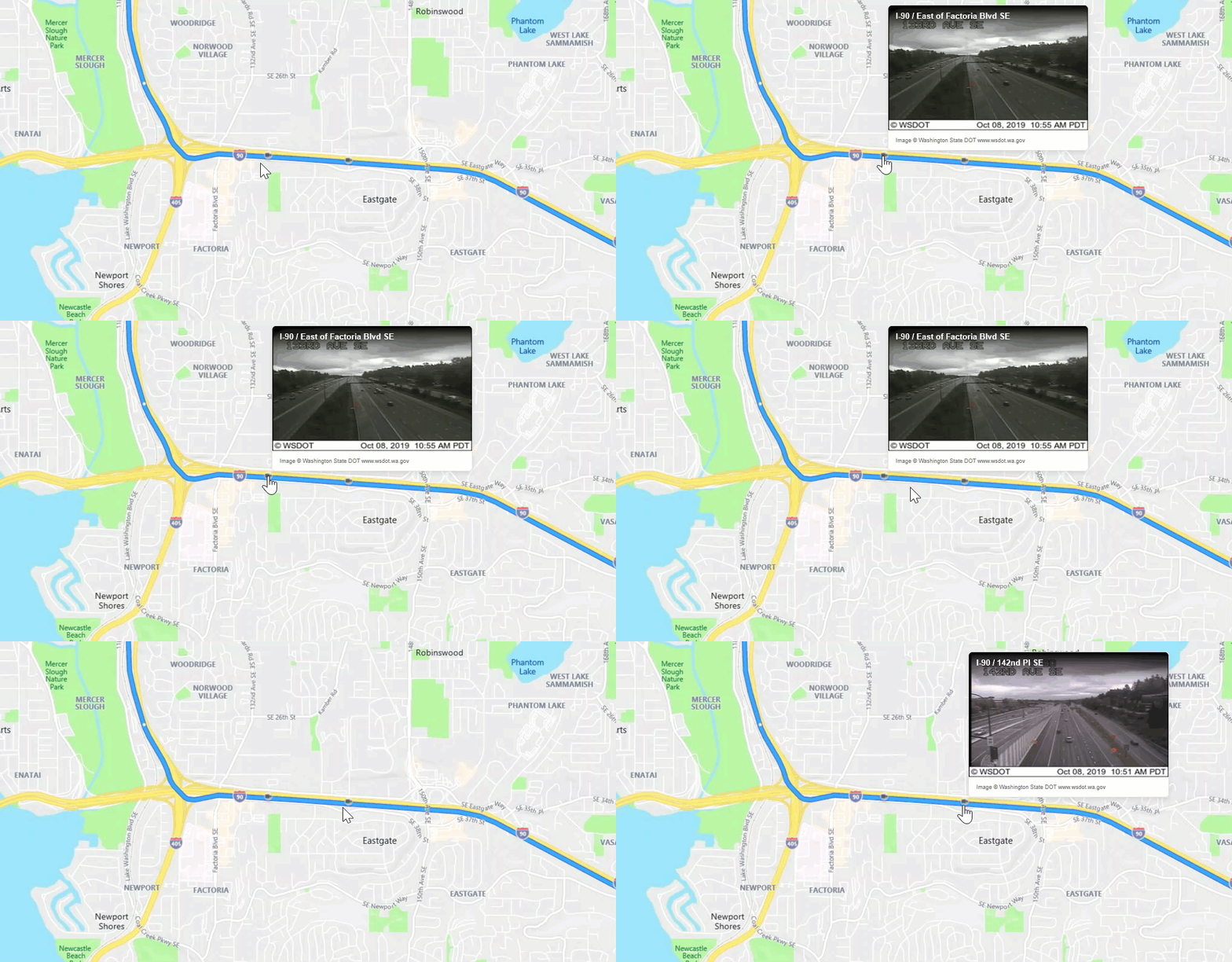
Hover to see traffic camera images or traffic incident details
In addition to clicking on the traffic camera icons on Bing Maps, traffic camera images and details can be accessed now by simply hovering over the camera icon along the planned route. Now you can quickly and easily glance at road conditions across your entire route.

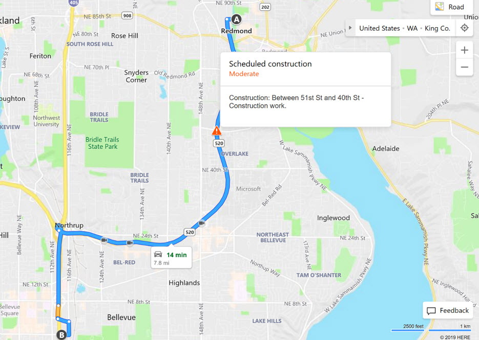
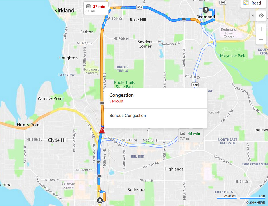
The Team also added traffic incident alerts along your planned route, which are shown as little orange or red triangle icons on the map. Just like the traffic cameras, you can view details about these traffic incident alerts by simply hovering over the little triangle icons. The examples below show traffic incident alerts about scheduled constructions and traffic ingestion respectively.


Changes in click behavior
While hovering over the cameras or incident icons launches a popup for the duration of the hover, a click will keep the popup window open until you click anywhere else on the map or hover over another incident or camera icon.
Best Mode Routing
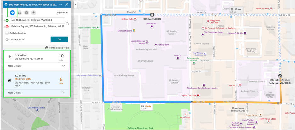
Sometimes, the destination you are trying to get to can be reached by different routing modes (e.g., driving, transit, or walking). In addition to allowing you to easily toggle between different routing modes on Bing Maps, we recently added a new default option of “Best Mode” to the Directions offering where you are served the best route options based on time, distance, and traffic. For example, for a very short-distance trip (e.g., 10 minutes walking), the "Best Mode" feature may recommend walking or driving routes because taking a bus such a short distance may not be the best option, considering wait time and bus fare. Likewise, for trips greater than 1.5 miles, walking may not be the best option. If a bus route requires several transfers, driving may be the better option.
The “Best Mode” feature allows you to view the best route options across modes without having to switch tabs for different modes. Armed with the recommended options and route details, you can quickly see how best to get to where you’re trying to go. Also, click on “More Details” to see detailed driving or transit journey instructions.

We hope these new features make life easier for you when it comes to getting directions and routing. Please let us know what you think on our Bing Maps Answers page. We are always looking for new ways to further improve our services with new updates releasing regularly.
– The Bing Maps Team
Source: Bing Blog Feed
