Azure Maps updates offer new features and expanded availability
This blog post was co-authored by Chad Raynor, Principal Program Manager, Azure Maps.
Updates to Azure Maps services include new and recently added features, including the general availability of Azure Maps services on Microsoft Azure Government cloud. Here is a rundown of the new and recently added features for Azure Maps services:
Azure Maps is now generally available on Azure Government cloud
The general availability of Azure Maps for Azure Government cloud allows you to easily include geospatial and location intelligence capabilities in solutions deployed on Azure Government cloud with the quality, performance, and reliability required for enterprise grade applications. Microsoft Azure Government delivers a cloud platform built upon the foundational principles of security, privacy and control, compliance, and transparency. Public sector entities receive a physically isolated instance of Microsoft Azure that employs world-class security and compliance services critical to the US government for all systems and applications built on its architecture.
Azure Maps Batch services are generally available
Azure Maps Batch capabilities available through Search and Route services are now generally available. Batch services allows customers to send batches of queries using just a single API request.
Batch capabilities are supported by the following APIs:
- Post Search Address Batch
- Post Search Address Reverse Batch
- Post Search Fuzzy Batch
- Post Route Directions Batch
What’s new for the Azure Maps Batch services?
Users have now an option to submit synchronous (sync) request, which is designed for lightweight batch requests. When the service receives a request, it will respond as soon as the batch items are calculated instead of returning a 202 along with a redirect URL. With sync API there will be no possibility to retrieve the results later. When Azure Maps receives sync request, it responds as soon as the batch items are calculated. For large batches, we recommend continuing to use the Asynchronous API that is appropriate for processing big volumes of relatively complex route requests.
For Search APIs, the Asynchronous API allows developers to batch up to 10,000 queries and sync API up to 100 queries. For Route APIs, the Asynchronous API allows developers to batch up to 700 queries and sync API up to 100 queries.
Azure Maps Matrix Routing service is generally available
The Matrix Routing API is now generally available. The service allows calculation of a matrix of route summaries for a set of routes defined by origin and destination locations. For every given origin, the service calculates the travel time and distance of routing from that origin to every given destination.
For example, let's say a food delivery company has 20 drivers and they need to find the closest driver to pick up the delivery from the restaurant. To solve this use case, they can call Matrix Route API.
What’s new in the Azure Maps Matrix Routing service?
The team worked to improve the Matrix Routing performance and added support to submit synchronous request like for the batch services described above. The maximum size of a matrix for asynchronous request is 700 and for synchronous request it's 100 (the number of origins multiplied by the number of destinations).
For Asynchronous API calls we introduced new waitForResults parameter. If this parameter is set to be true, user will get a 200 response if the request is finished under 120 seconds. Otherwise, user will get a 202 response right away and async API will return users an URL to check the progress of async request in the location header of the response.
Updates for Render services
Introducing Get Map tile v2 API in preview
Like Azure Maps Get Map Tiles API v1, our new Get Map Tile version 2 API, in preview, allows users to request map tiles in vector or raster format typically to be integrated into a map control or SDK. The service allows to request various map tiles, such as Azure Maps road tiles or real-time Weather Radar tiles. By default, Azure Maps uses vector map tiles for its SDKs.
The new version will offer users more consistent way to request data. The new version introduces a concept of tileset, a collection of raster or vector data that are further broken up into a uniform grid of square tiles at preset zoom levels. Every tileset has a tilesetId to request a specific tileset. For example, microsoft.base.
Also, Get Map Tile v2now supports the option to call imagery data that was earlier only available through Get Map Imagery Tile API. In addition, Azure Maps Weather Service radar and infrared map tiles are only available through the version 2.
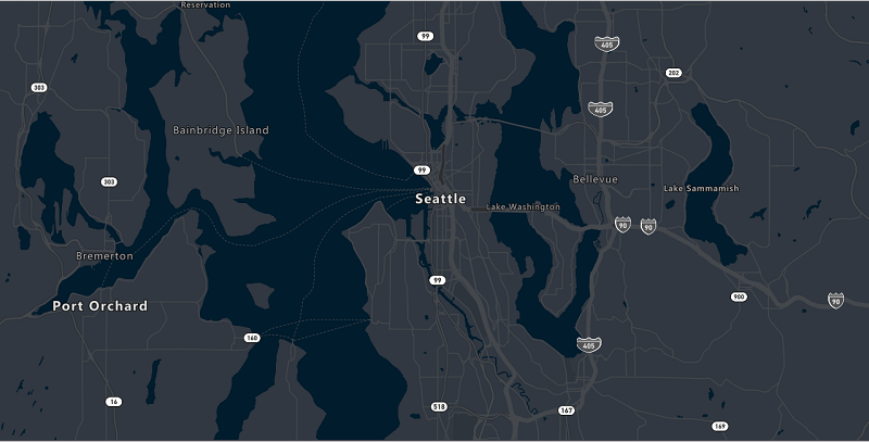
Dark grey map style available through Get Map Tile and Get Map Image APIs
In addition to serve the Azure Maps dark grey map style through our SDKs, customers can now also access it through Get Map Tile APIs (version 1 and version 2) and Get Map Image API in vector and raster format. This empowers customers to create rich map visualizations, such as embedding a map image into a web page.

Azure Maps dark grey map style.
Route service: Avoid border crossings, pass in custom areas to avoid
The Azure Maps team has continued to make improvements to the Routing APIs. We have added new parameter value avoid=borderCrossings to support routing scenarios where vehicles are required to avoid country/region border crossings, and keep the route within one country.
To offer more advanced vehicle routing capabilities, customers can now include areas to avoid in their POST Route Directions API request. For example, a customer might want to avoid sending their vehicles to a specific area because they are not allowed to operate in the area without a permission form the local authority. As a solution, users can now pass in the route request POST body polygons in GeoJSON format as a list of areas to avoid.
Cartographic and styling updates
Display building models
Through Azure Maps map control, users have now option to render 2.5D building models on the map. By default, all buildings are rendered as just their footprints. By setting showBuildingModels to true, buildings will be rendered with their 2.5D models. Try the feature now.

Display building models.
Islands, borders, and country/region polygons
To improve the user experience and give more detailed views, we reduced the boundary data simplification reduction to offer better visual experience at higher zoom levels. User can now see more detailed polygon boundary data.
 Left: Before boundary data simplification reduction. Right: After boundary data simplification reduction.
National Park labeling and data rendering
Based on feedback from our users, we simplified labels for scatters polygons by reducing the number of labels. Also, National park and National Forest labels are displayed already on zoom level 6.

National Park and National Forest labels displayed on zoom level 6.
Send us your feedback
We always appreciate feedback from the community. Feel free to comment below, post questions to Stack Overflow, or submit feature requests to the Azure Maps Feedback UserVoice.
Source: Azure Blog Feed